Event Date
New research satellites for Climate Adaptation Research
Presented by: Dr. Susan Ustin
There are many new satellite and airborne instruments now flying or are under development that will collect data relevant for climate adaptation research. New technologies include multi- and hyperspectral images in the optical and thermal spectrum, multiband lidar and radar flown across a range of spatial and temporal resolutions. Additionally, many of these are being built in the EU (and other countries) following NASA’s model for free and open data access. I will discuss what some of these new instruments are and what kinds of new (or better) information can be expected. Email Dr. Susan Ustin
About the Presenter

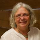
Distinguished Professor, Emeritus, Department of Land Air and Water Resources, John Muir Institute of the Environment
Dr. Susan Ustin has 35 years of experience in working with remote sensing instruments to study and understanding ecosystem processes. Her research has focused on detection of ecophysio-logical traits and processes in relation to remotely sensed characterization of stressed vegetation from climate variability and change. Her work includes wildfire-related research at local to regional scales that address risk, mitigation, and adaptation. Dr. Ustin’s research includes forest structure, drought and wildfire risk, quantifying live fuel loads, and recovery after wildfire. She has also worked on impacts of multiple stressors, including Gulf oil spill and subsequent hurricane damage.